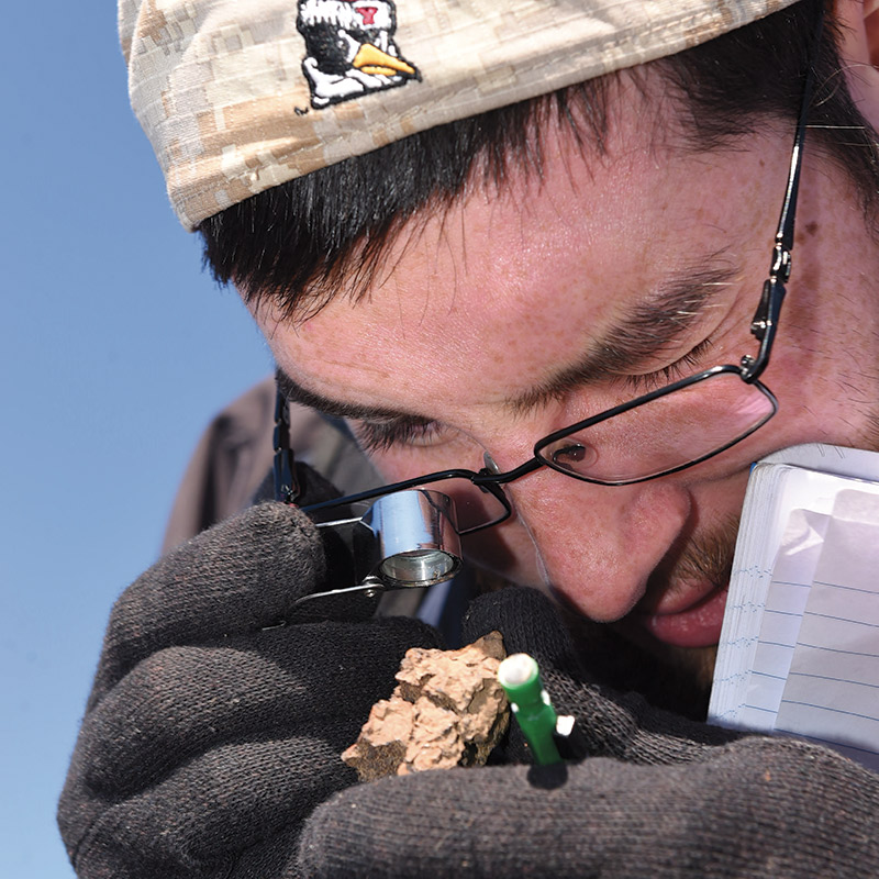


Mathur, who is teaching Juniata’s Geophysics course at the time of this excursion, leads students, guest geologists, reporters, and a few others across the field. The troupe tramps through old corn cobs, snapped plant stalks, and the occasional animal dropping for a significant amount of time before stopping.
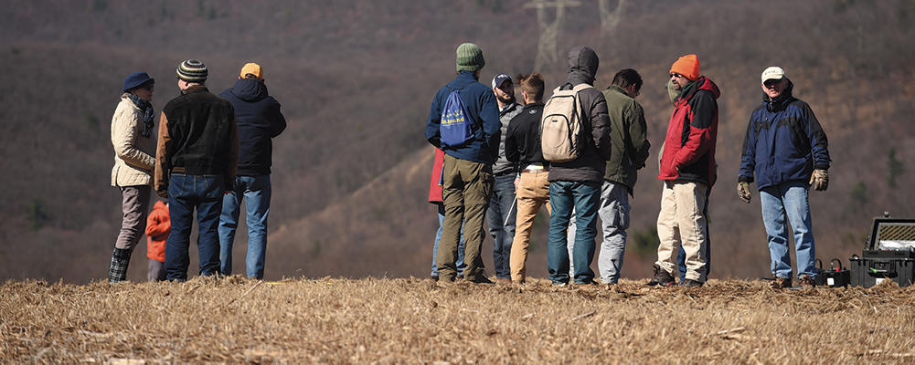
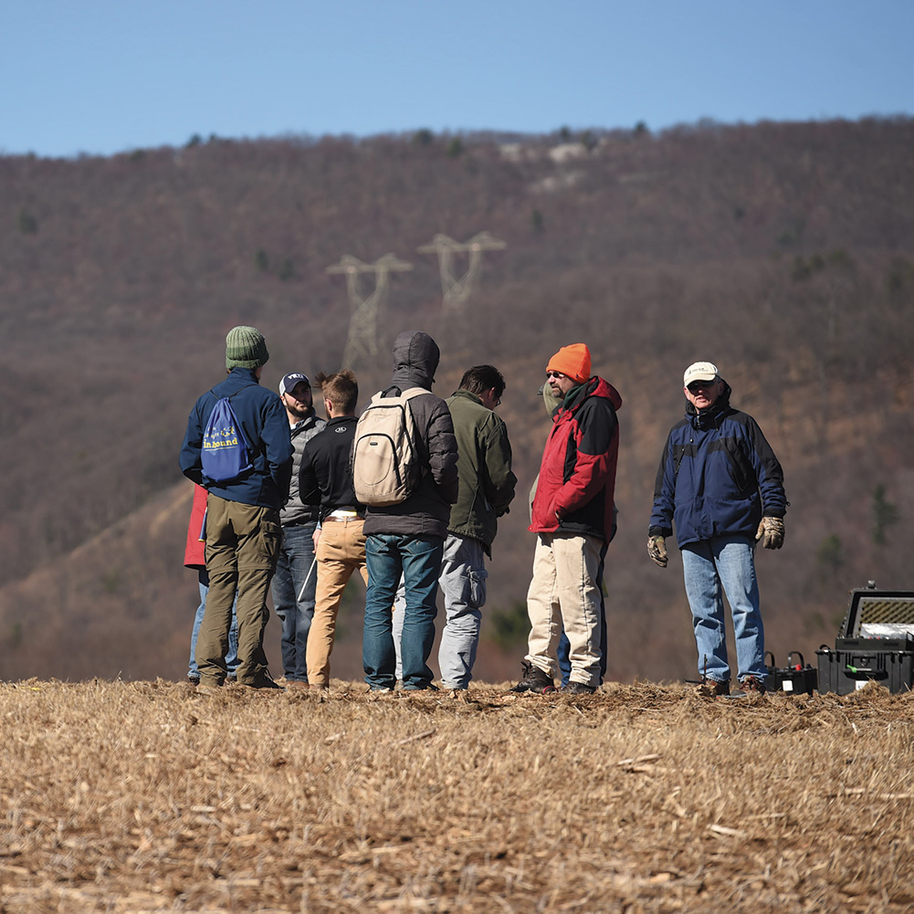
Members of the group look at their feet. There’s no plant life, no corncobs. Just rocks and soil stretching about 20 yards in an irregular oval—about the same amount of space taken up by a swimming pool.
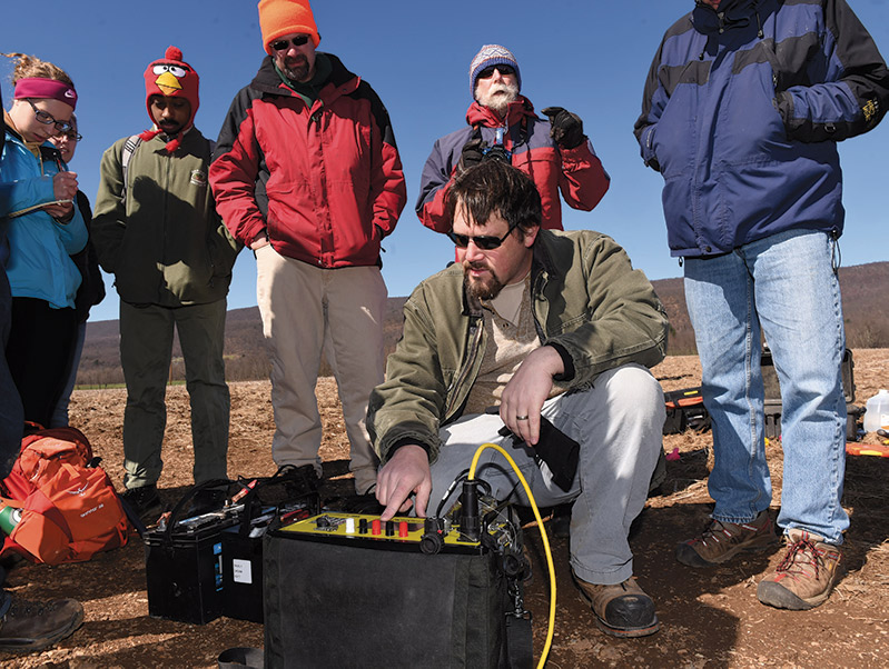
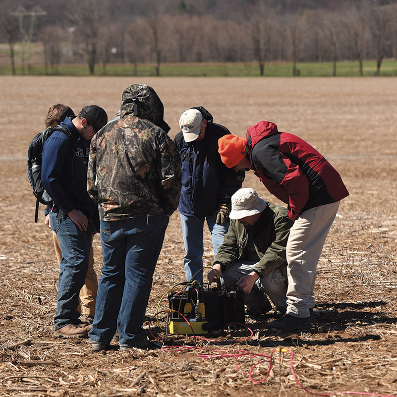
Following close behind Mathur, like ducklings lugging heavy equipment, are more than a dozen Juniata geology students enrolled in Mathur’s Geophysics course. “OK, we’re going to set up here,” Mathur instructs the group. “Let’s get the resistivity test set up.”
The group is in this cornfield to determine if they could find any historical or physical evidence of a lead-mining site near Fort Roberdeau. A rebuilt fort marking the site of a colonial fort that existed roughly from 1750 until shortly after the Revolutionary War, Fort Roberdeau’s mission was to protect settlers and an extensive lead mining operation that provided the raw ore to make lead ammunition for the war effort.
However, the path into that cornfield started much earlier at an academic conference. At a meeting of the Nittany Mineralogical Society, Mathur heard a presentation by George Pedlow, a retired geology consultant from State College, Pennsylvania, that detailed a mystery— where exactly were these Sinking Valley lead mines located?
Mathur heard the talk and decided to invite Pedlow to his classroom to speak. That talk led directly to the jumble of students, journalists, and geologists spending a Saturday in a chilly central Pennsylvania field.
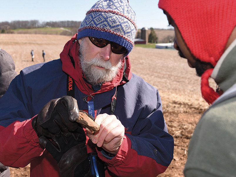
“Karen Morrow, who does historical interpretation at the fort, had collected a variety of historical maps, magazine articles, and even a letter to the editor that referred to locations of lead mines in the valley,” Pedlow says. “The problem was that in this 200- year period, no one wrote down anything definitive about this mining operation.”
“If you’re going into geophysics, you have to get experience using the equipment—that’s what it’s all about.”Jim Stuby ’94, Project Geophysicist, Earth Resource Technology, Laurel, MD.
Dr. Lauren Hughes, Pennsylvania’s Deputy Secretary for Health Innovation, also praised the students’ work. One of their instructors for the health communication practicum, Dr. Robert Gillio, a pulmonologist who serves as medical director for population health and clinical innovation with the health system, said, “I’d be proud to take these students anywhere.”
Pedlow had led a Harrisburg Geological Society field trip to the valley, where he and Duff Gold, professor emeritus of geology at Penn State University, were able to pick up lead ore on several sites near the fort. Gold passed the samples to Mathur to do some tests to determine the age of the lead deposits. Looking for a project to give his students field experience, Mathur asked Pedlow to talk to the class and help lead a class trip.
“It’s really neat to be able to engage students at the beginning of their career on a one-off research opportunity that no one has done before,” Pedlow says.
To make the field trip happen, Mathur gathered Pedlow, Fort Roberdeau historian Karen Morrow, and Jim Stuby ’94, a project geophysicist with Earth Resources Technology in Laurel, Maryland, to see if the class could use advanced instrumentation to locate evidence of a mine.
Stuby, who had visited Juniata classes before with geophysics instruments, brought a resistivity meter, and a ground-penetrating radar instrument that looked like an oversized lawn mower with a small TV attached to the push bar.
“I like coming down to teach students how to use the equipment,” Stuby says. “If you’re going into geophysics, you have to get experience using the equipment—that’s what it’s all about.”
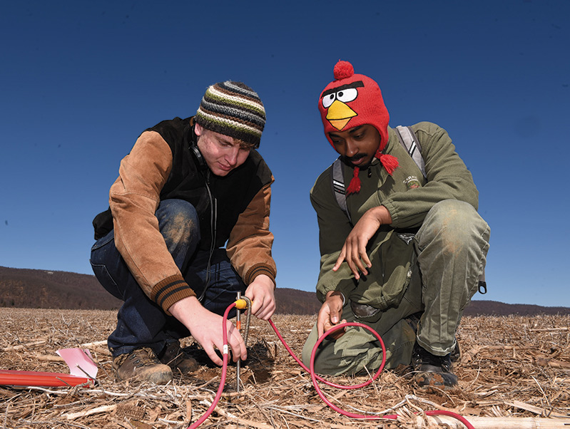
Back in the Fort Roberdeau farm field, which the fort owns but is planted by a local farmer, the students fan out in a straight line, hammering in electrodes every three meters to a length of about 100 meters in each direction from the resistivity meter, which is plopped right in the middle of the cornfield’s barren area.
Each electrode, which looks like a two-foot-long spike, is hammered into the ground and hooked up to wires. Electricity is sent into the ground and then measured. Different materials under the surface produce unique resistivity measurements.
For instance, solid rock has very high resistivity, while disturbed or jumbled earth would have a low resistivity measurement.
“The resistivity test goes down to about 30 meters in depth,” Mathur explains. “Geologists do similar tests when they are looking for metals.”
The field experience available to the students gives those who want to pursue a geology career a leg up on the competition. “I had no idea what I wanted to do coming into Juniata,” says Ben Gemballa ’18, of Apollo, Pa. “I took Geophysics and I loved it. There are many opportunities developing in the field. Out here now we’re doing stuff that only grad students would do.”
Gemballa says geophysicists are involved in all aspects of geology, mining, oil exploration, environmental remediation, and a host of other opportunities.
The group took about three to four hours to lay out the first set of electrodes. Once the resistivity meter was giving out readings, the students laid out three more lines parallel to the original setup. The parallel layout would give the students a wider range of imagery along the same plane. If they were lucky, the test could reveal an anomaly under the ground that might indicate past mining activity.
“I had no idea what I wanted to do coming into Juniata. I took Geophysics and I loved it. There are many opportunities developing in the field. Out here now we’re doing stuff that only grad students would do.”Ben Gemballa ’18, Apollo, PA.
The tests revealed a 12-meter-deep “divot” in the subsurface, as if a giant golf club had taken a scoop of earth out during a swing.
“We took out the ground-penetrating radar and went over the surface,” Mathur explained. “The GPR can reveal the subsurface to a depth of about five to 6 meters.”
The image on the radar proved illuminating as the screen showed vertical wavy lines in the scooped-out area. “That means the ground was disturbed here,” Mathur says. “It’s a jumble of gravel that has been in-filled by sediment.”
According to Mathur and Pedlow, the students’ discovery of the divot indicates that there was a Revolutionary War-era mine on that site. “We can use this data to continue looking at likely sites in the Fort Roberdeau area.”
For Tara Fowler ’19, of Hellam, Pa., the field experience provided an effective addition to her skills. “It was great to collaborate and make our contribution to the scientific community and world knowledge.”
In the following October, Mathur, Fowler, and a few other Juniata students presented the Fort Roberdeau project at the Field Conference of Pennsylvania Geologists in State College. In addition, one of the conference field trips visited the sites at the historic fort. “The ultimate goal can be getting to the point where we can identify all the original Revolutionary War sites,” Pedlow says.
“It’s pretty amazing we found a possible mine site on the first try,” Mathur says. “In science that almost never happens. It will be fun expanding on the study in the coming years and adding a bit more to the picture of Fort Roberdeau’s past.”
In the coming year, Mathur and his students will work on finding a forge near the fort. >J<